
TideGateway · A MassBays resource
Understand tide gates.Plan for a changing coast.
Explore the structures that shape water flow through the Massachusetts Bays region. TideGateway brings together site records, field surveys, and practical resources to support tide gate management and salt marsh restoration.
Public maps and records. No account needed to explore.
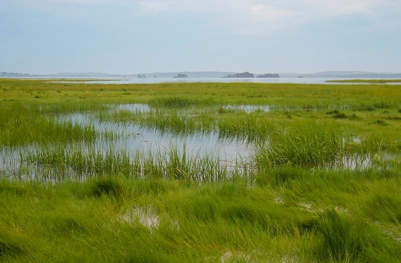
Connected by the tides
The connection between land and sea
A gate changes more than the water level.
Tide gates are structures that control the passage of tidal water. Some open and close with the tides; others are operated manually or mechanically. They can help manage flooding and drainage, while also changing how much salt water reaches the wetlands upstream.
Coastal water
Tide gate
Tidal wetland
Gate design, condition, and operation influence the exchange of water between the coast and the habitat beyond it.
Flood management
Understanding a gate’s condition and purpose helps communities consider maintenance and flood management needs as sea levels rise and infrastructure ages.
Salt marsh health
Restricted tidal flow can change salinity, drainage, and vegetation. Healthy salt marshes support wildlife, store carbon, and help protect shorelines from erosion.
Connected habitats
Tide gates can affect fish passage and access to upstream habitat. Looking at both the structure and its surroundings helps identify opportunities for restoration.
Learn more about habitats in the Bays.
From information to actionStart with a place.
Start with a place.
Build the picture.
Whether you manage local infrastructure, study coastal habitats, or want to understand a site in your community, TideGateway gives you a shared starting point.
Records combine historic inventories and newer field surveys. Dates and available information vary by site. Check the survey details when using a record to inform your work.
01
Find a tide gate
Explore locations on the map, or search the inventory and filter by town.
Open the map02
Understand the site
Review gate type and condition, ownership and operations, photographs, and marsh assessments where available.
Explore site records03
Plan the next step
Use field protocols, the O&M plan template, and monitoring guidance to support assessment, maintenance, and restoration planning.
Browse resourcesPractical resources
All resources Support for work on the ground.
Assess a site
Open the tide gate survey and download field assessment protocols.
Field survey & protocolsPrepare an O&M plan
Use CEI’s template to document operations, maintenance, and inspections.
Open the plan templateMonitor restoration
Review guidance for water levels, water quality, vegetation, and marsh elevation.
Monitoring guidanceRooted in the Massachusetts BaysLocal knowledge.
Local knowledge.
Regional perspective.
From Salisbury to Provincetown, the MassBays region connects coastal communities around Ipswich, Massachusetts, and Cape Cod Bays. TideGateway brings tide gate information together to help those communities understand their infrastructure and coastal habitats.
About TideGateway
TideGateway is a resource of the Massachusetts Bays National Estuary Partnership (MassBays). Based at UMass Boston’s School for the Environment, MassBays supports 50 coastal communities with science and technical assistance to protect and restore coastal habitats.
Meet MassBays Part of the Massachusetts Bays Program
© 2026 Massachusetts Bays Program. Monitoring tidegates across Massachusetts.